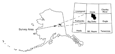
Burns, L.E., Barefoot, J.D., Graham, G.R.C., Naibert, T.J., Geoterrex-Dighem, and Stevens Exploration Management Corp., 2019, Salcha River-Pogo electromagnetic, magnetic, and radiometric airborne geophysical survey data compilation: Alaska Division of Geological & Geophysical Surveys Geophysical Report 2019-8, 22 p. https://doi.org/10.14509/30179
 Report Information
 Geospatial & Analytical Data
Aeromagnetic; Aeromagnetic Data; Aeromagnetic Map; Aeromagnetic Survey; Airborne Geophysical Survey; Analytic Signal; Anderson Creek; Apparent Resistivity Data; Apparent Resistivity Map; Apparent Resistivity Survey; Bear Creek; Big Granite Creek; Black Bear Creek; Blackshell Creek; Bluestone Creek; Bonanza Creek; Bullfrog Creek; Butte Creek; Camp Creek; Caribou Creek; Conductivity Survey; Dan Creek; East Fork Chena River; Eldorado Creek; Electromagnetic Data; Electromagnetic Survey; Exploration; Fairbanks Mining District; First Vertical Derivative; Flume Creek; Frequency Domain Electromagnetic Data; Geologic; Geology; Geophysical Map; Geophysical Survey; Geophysics; Geophysics Search Tag; geoscientificInformation; Glacier Creek; Gold Creek; Goodpaster Mining District; Goodpaster River; Goose Creek; Graystone Creek; Gridded Data; Indian Creek; Line Data; Little Gold Creek; Little Granite Creek; Lohi Creek; Lower Boulder Creek; Magnetic Data; Magnetic Survey; Magnetics; Maiden Creek; Mascot Creek; Middle Fork Chena River; No Grub Creek; North Fork Salcha River; Ottertail Creek; Palmer Creek; Pasco Creek; Pogo Mine; Porcupine Creek; Quartz Creek; Remote Sensing; Resistivity; Resistivity Survey; Ricks Creek; Salcha River; Shamrock Creek; Shaw Creek; Sonora Creek; South Fork Salcha River; Stone Boys Tent Creek; Sullivan Creek; Teuchet Creek; Upper Boulder Creek; Wickersham Creek