Digging out solar panels on the Mount Doran repeater station after a long winter buried by rime ice and snow drifts. Photo Credit: N. Avdievitch, USGS.
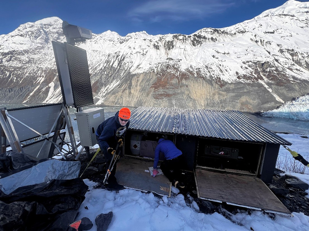
Accessing the ground based radar hut for repairs and upgrades.
Photo Credit: N. Avdievitch, USGS.
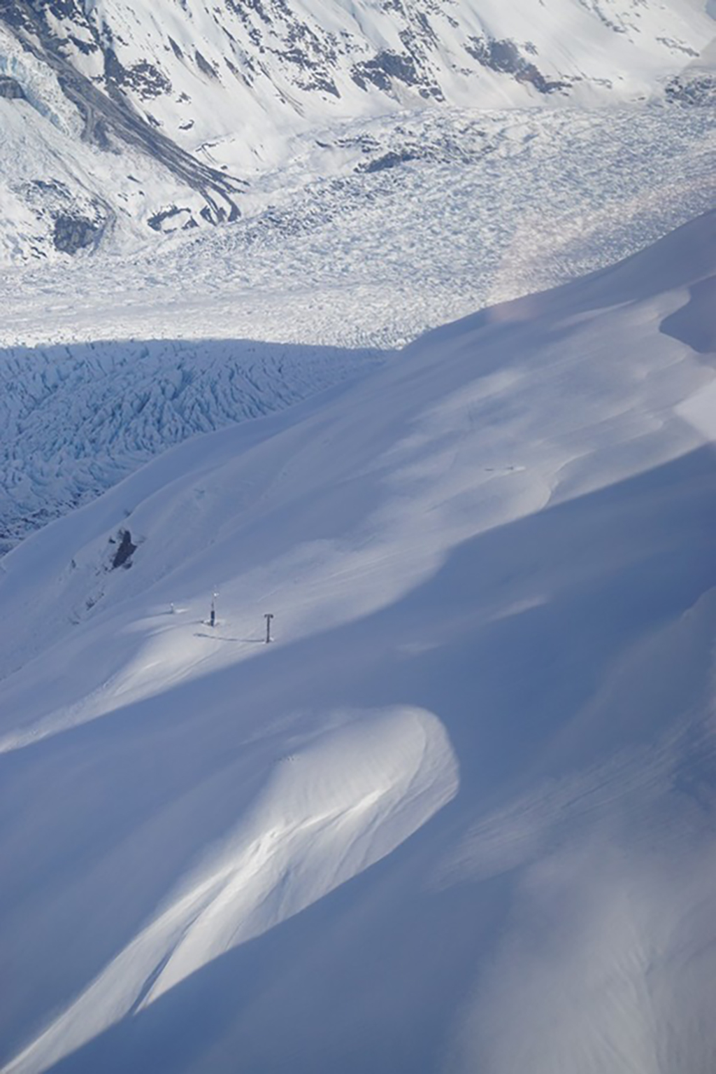
The infrasound at BAE and other high elevation instrumentation sites are still buried under a deep snowpack.
Photo Credit: H. Rosenkrans, USGS.
We want to share an update regarding operational challenges affecting the Barry Arm Landslide and Tsunami Hazard Monitoring System, which may have temporary impacts on tsunami hazard awareness and response efforts in the region.
Recent changes in operational policies at partnered Federal agencies have resulted in delays in equipment repairs and service renewals essential to maintaining full operational readiness. We recognize the importance of this monitoring system to our federal, state, and local partners, including the U.S. Forest Service, Alaska Division of Homeland Security and Emergency Management, the U.S. Coast Guard, the City of Whittier, and the City of Valdez. We are working closely with agency leadership to address these challenges and minimize impacts to emergency preparedness and response operations.
We appreciate your patience and continued collaboration as we adapt to changes and implement solutions to operational challenges.
Engineers from the National Tsunami Warning Center have completed repairs to the tide sensors in Whittier Harbor and Barry Arm and are working on reestablishing data connections and power to the Port Wells sensor.
On Wednesday, April 2nd scientists from the U.S. Geological Survey (USGS) conducted maintenance operations in Barry Arm on the ground-based radar and the repeater site at Mount Doran.
Highlights of the trip from include:
There is no upcoming fieldwork planned for the rest of the month of April. There is annual spring maintenance planned for May and a note on this activity will be posted in next month’s update on May 2nd, 2025.
An ongoing landslide and landslide-generated tsunami threat exists in Barry Arm, northwestern Prince William Sound, Alaska. The landslide is stable or exhibiting slow rates of deformation (<50 mm/d). Localized areas of higher velocities may be evident, but movement is largely surficial. While potential failure of these areas may result in a localized tsunami, failure is unlikely to represent a region-wide tsunami threat. Partial or catastrophic rapid failure is unlikely without external forcing, such as that associated with a strong regional earthquake. "Small" but infrequent rockfalls and shallow landslides may be commonly observed.
Mariners should remain vigilant when in the vicinity of Barry Arm or nearby waters and be prepared to depart the area if any unusual rockfall activity is seen or heard, or if unusual waves, currents, or tides are observed.
(Last updated February 2, 2024)
The Barry Arm landslide is a large (~500 M m3 or 650 M yd3) landslide located in the northwestern corner of Prince William Sound, Alaska. Rapid failure of the landslide has the potential to create a tsunami that results in life-threatening waves and currents in Barry Arm, Harriman Fjord, Port Wells and adjacent fjords. The existence of the landslide is evident in photographs dating back to at least 1935, with possible evidence of the landslide in photographs dating to 1913.
Throughout the observational record, the Barry Arm landslide has experienced slow movement punctuated by episodes of acceleration. While slow downslope movement is both common and expected, rapid increases in the rate of movement may be a possible precursor to catastrophic failure. As such, observations and hazard messages are often centered around trends in the observed rates of downslope movement at Barry Arm, as measured by ground-based, aerial, and satellite surveillance methods.
The Barry Arm landslide is being monitored by a multiagency team of scientists from the U.S. Geological Survey (USGS), National Tsunami Warning Center (NTWC), Alaska Division of Geological & Geophysical Surveys (DGGS), and the University of Alaska Fairbanks Alaska Earthquake Center (AEC). For more information on monitoring activities, equipment and data availability, please visit https://landslides.usgs.gov/storymap/barry-arm/.
(Last updated February 2, 2024)
Scientists at USGS, DGGS, AEC, and NTWC will continue to make every effort to minimize outage of this critical network of sensors. The Alaska environment and its inhabitants can wreak havoc on our sites: strong winds can damage sensors, power components, and antenna; deep snow can bury instruments and solar panels and makes it difficult to access (and even find) sites, rain can work its way into sensitive electronics, and our four-legged neighbors, such as bear, deer, and goats, have a taste for our wiring and enclosures. While we have made our best effort to harden the sensors, power systems, and telemetry for continuous operation of the equipment and to resist weather and animals, it is necessary to have reasonable expectations given the difficulties of working in this harsh environment. Reasonable expectations include:
| Monitoring Method | Agency | Operational Status | Notes |
|---|---|---|---|
| Water Level | NTWC | Limited | Whittier Harbor and Barry Arm are online, Port Wells is currently being repaired |
| Seismic - BAE | AEC | Online | |
| Seismic - BAT | AEC | Online | |
| Infrasound - BAEI | USGS | Online | |
| Ground-Based Radar | USGS | Online | Cellular connection to radar repaired, new fuel cell and batteries installed |
| Deformation camera | USGS | Online | |
| Satellite InSAR and imagery | USGS | Limited | Loss of coherence in winter as a result of snow conditions |
| Hydrometeorology - BAE | DGGS | Online | |
| Hydrometeorology - BAW | DGGS | Online | |
| Hydrometeorology - Mt Doran | DGGS | Online |
This message will be updated on May 2, 2025, or earlier if the threat level changes. For more information, please see our Barry Arm Summary Information & FAQ page.