Most oil and gas produced from North Slope and Cook Inlet fields comes from reservoirs made of porous and permeable sandstones and conglomerates. Sedimentologists in the Energy Resources Section conduct studies of similar lithologies in outcrop and the subsurface to characterize their potential to serve as oil and gas reservoirs. To carry out these studies, we acquire new data in the field by measuring detailed stratigraphic sections and, in the subsurface, by describing cores. Measured sections and core descriptions are the basis for detailed facies analyses and process-response sedimentological interpretations, which are used to reconstruct depositional systems and place them in a sequence stratigraphic framework to help predict the distribution of sand-prone successions, sand body geometries and, ultimately, reservoir potential. Geologists in the section are beginning to use structure-from-motion data to create geometrically correct outcrop photo-mosaics that serve as base maps for mapping sedimentary facies and reconstructing sand body geometries. Structure-from-motion data, combined with detailed stratigraphic and sedimentological observations, allow the construction of geometrically correct outcrop analogue models of potential reservoir intervals.

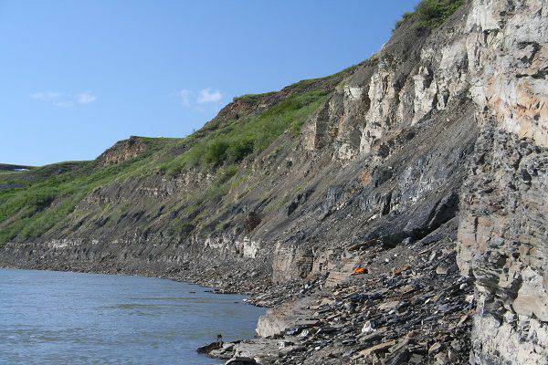
Exposure of the Nanushuk Formation along the north side of the Colville River, north of Ivotuk. The gently dipping beds above the coal seam are part of a bayhead delta that pro-graded into a interdistributary bay. View is toward the west. Photo credit: David L. LePain, DGGS.

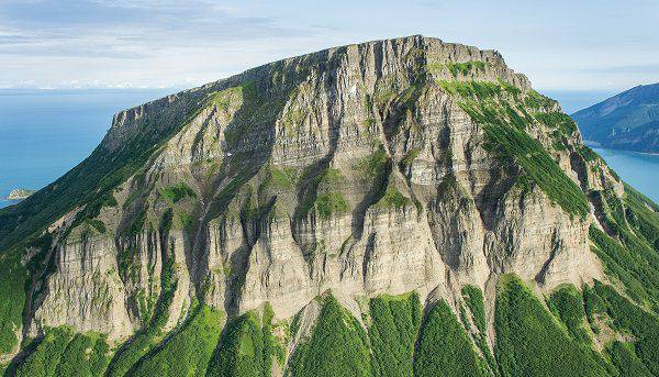
Aerial view of the north end of Chisik Island. Beds above the vegetated apron at the base of the cliff belong to the Upper Jurassic Naknek Formation. The Naknek at this location includes a seismic-scale sub-marine canyon filled with deepwater deposits. Photo credit: Trystan M. Herriott, DGGS.